
We are not alone in thinking that the Whole Enchilada is the best ride in the world. Yes, we are biased because it is in our backyard, but hear us out as to why we think so:
The Varied Terrain
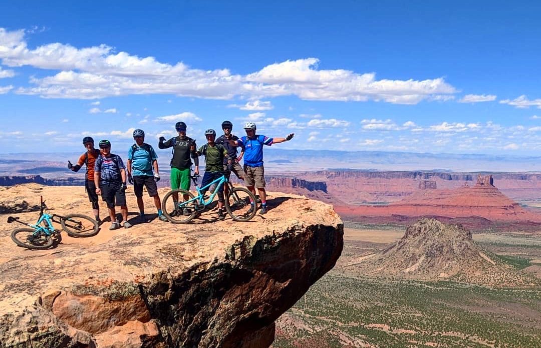
The Whole Enchilada is a series of trails linked together and there are not many other places in the world that combine such varied terrain into one epic experience. The top of the Whole Enchilada starts above 10,000 ft with a shuttle up to the Burro Pass trailhead. Don’t get your hopes on starting to descend right away. The trail turns very sharply uphill to take you to the pass the trail is named after, at an elevation of over 11,000 ft. This is where the fun starts as you descend through pine forests and down into the aspen groves. The trail is rocky, loose and steep!
 Riders making their way to the top of Burro Pass, the high point of the Whole Enchilada.
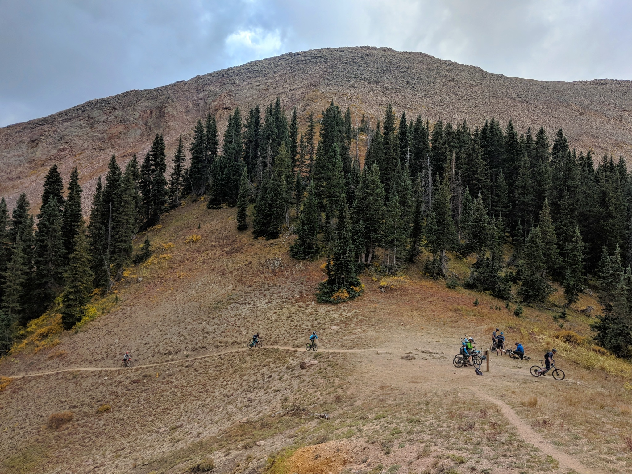
The next trail you reach is Hazzard
- a more flowy (at least by Moab standards) descent through more aspen groves and down into the scrub oak. There are plenty of rocks and fast corners to keep things fun, and the epic views begin as you pop out of the trees. Take a breather at the overlook before descending Kokopelli trail, a fast jeep road section that will take you to the first of three sections along the famed Porcupine Rim.
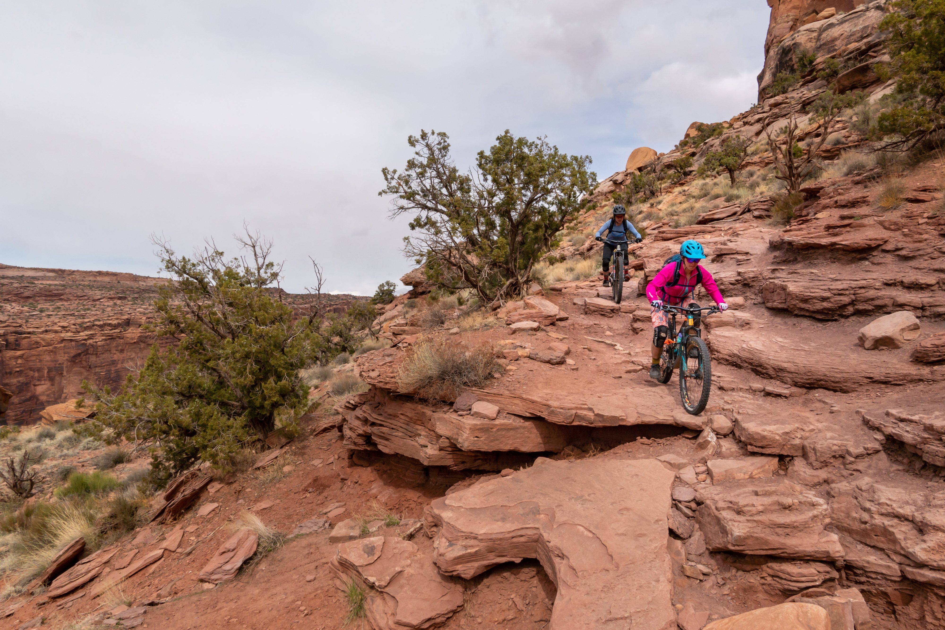
UPS (Upper Porcupine Singletrack) is first up and is a fan favorite of slickrock rollers, fast corners and enough tech to keep you honest. Next up is LPS (Lower Porcupine Singletrack) and the rest of the ride gets progressively more technical and chunky. This section of trail is home to the infamous Snotch
- ride at your own risk or carefully walk your bike down like most mere mortals.
- this is some of the chunkiest Jeep road around and it will keep you on your toes eyeing up the many line choices available.
After your bones have been thoroughly rattled through many miles of rocky descending, you finally get to what most people consider the best part
- the Porcupine Singletrack. This is the final four miles of trail and some of the most fun technical riding, with views of the Colorado River and the end of the ride in sight. There is nothing quite like getting down to the river at the end of your Whole Enchilada adventure!
It’s mostly downhill with a few climbs to keep it interesting
Yes, it’s a shuttled ride, so you will be MOSTLY descending (around 8,000 ft total) but that doesn’t mean there isn’t any climbing along the way (almost 2000 ft of it!). Right off the bat, you will do a big push up to Burro Pass before starting the descent. The next significant climb is at the start of Hazzard and then there are smaller ones sprinkled throughout the ride. Don’t this scare you away
- the descending is more than worth it!
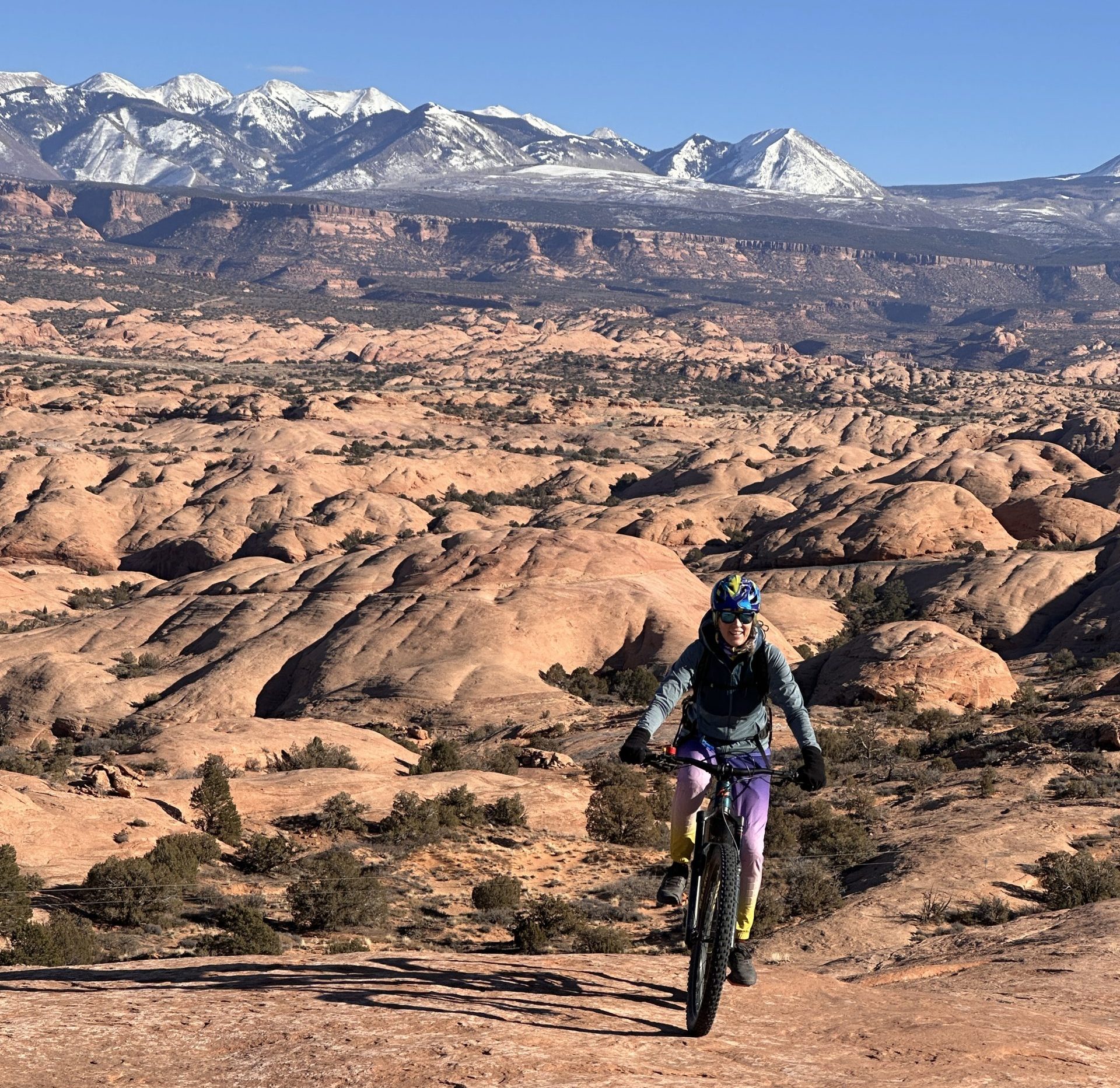
Some of the best views
You cannot beat the views along the Whole Enchilada route. You will start in the La Sal mountains with spectacular views of many peaks in the range. As you descend, you will start to get views into the desert below. We recommend taking a pause once you have finished the initial Hazzard climb to take in the scenery
- mountains in one direction, sweeping views of the desert in another. Once down on Porcupine Rim, you will get the classic Castle Valley view that the Whole Enchilada is famous for! But the views don’t end there- along the jeep road section, you can look out onto the petrified sand dunes of the [Slickrock Bike Trail](https://rimtours.com/adventure-west/the-slickrock-trail/), into Arches National Park in the distance and then views of the Colorado River corridor as you get down to the Porcupine Singletrack.
 Catching the Whole Enchilada makes the mountain views even more spectacular.
#
When to ride the Whole Enchilada
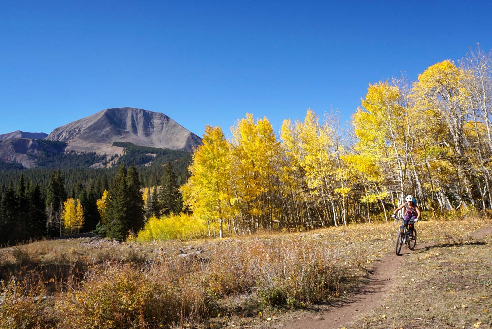
The full ride on all of the sections of trail has a relatively short window. The top trail Burro Pass opens for commercial shuttling starting on July 1 but unless you are very heat tolerant, the summer is not a great time to ride it, and it can be dangerous since the further you ride, the lower the elevation, and the hotter the temperature (during the summer it can be well over 100 for half the trail). That leaves late September and sometime into October to ride the trail during good weather. During that time, there is always a chance for snow up high. If you can time it just right to avoid the snow and catch the fall leaves, there is not much better of a day on the bike!
Are you riding the trail for your first time and want some guidance and expert lines? We offer [guided tours](https://rimtours.com/tours/whole-enchilada-hazzard/) to make the experience even better! Have a wheel to follow through the technical features and know whats coming up.